

The Giewont hike is a demanding but rewarding day walk suited to fit adults comfortable with exposed scrambling. For first-timers, the Kuźnice → Hala Kondratowa → Kondracka Pass → summit route is the standard choice: roughly 11.8 km round trip, around 912 m of ascent, and a typical moving time of 5–6 hours. The summit sits at 1,894 m above sea level, and the final 100–200 m involves steel chains on polished limestone. If you have a serious fear of heights, this is not the hike for you. Everyone else, read on.
Quick facts at a glance:
- Summit elevation: 1,894 m
- Round-trip distance: 11–12.2 km (route dependent)
- Typical duration: 4.5–6.5 hours (fit to average pace, including queues)
- Trailhead: Kuźnice, on the southern edge of Zakopane
- Park: Tatra National Park (entry rules apply)
- Guided option: ComFort Tours Cracow offers small-group day trips from Kraków
Key takeaways
The Giewont hike rewards fit, well-prepared walkers who start early and respect the mountain’s weather. The chain section is the crux: manageable for most adults, but not to be underestimated on wet rock or in a queue.
| Point | Details |
|---|---|
| Start early | Leave Kuźnice by 06:30 to reach the chains before queues build and be off the summit by 13:00. |
| Wear the right boots | High-grip hiking boots with ankle support are non-negotiable on polished limestone; trail runners are inadequate. |
| Watch the weather | Check Tatra National Park bulletins and TOPR forecasts on the morning; turn back at Kondracka Pass if storms are forecast. |
| Know the emergency number | Save TOPR mountain rescue (985 / +48 18 206 34 44) to your phone before leaving Zakopane. |
| ComFort Tours Cracow | Offers small-group guided Giewont ascents with transfers from Kraków, removing logistics and route-finding stress. |
Table of Contents
- Quick facts: distance, ascent, difficulty and hazards
- Which Giewont route should you choose?
- Step-by-step timed itinerary from Kuźnice
- What makes the Giewont ascent technically demanding?
- When is the best time to hike Giewont?
- How do UK travellers get to Kuźnice?
- Safety, weather and mountain rescue
- What to pack for the Giewont day hike
- Mountain huts and facilities on the route
- Should you hike Giewont with a guide?
- An honest take on the Giewont hike
- Plan your Giewont day with ComFort Tours Cracow
- Key Takeaways
- Sources
- FAQ
Quick facts: distance, ascent, difficulty and hazards
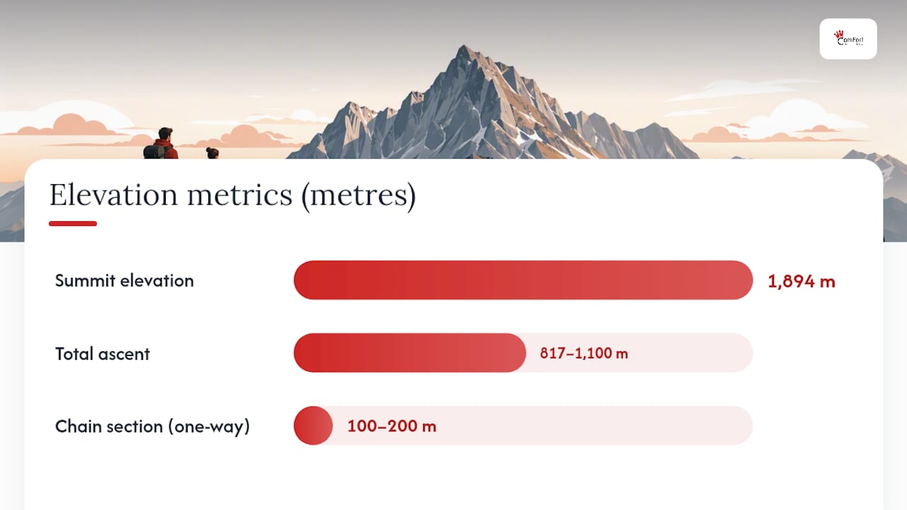
AllTrails user data records the Kuźnice route at 12.2 km with 817 m of elevation gain and an average completion time of around 5–5.5 hours. HikeList classifies it as a hard day hike with approximately 11 km out-and-back and up to 1,100 m of climb depending on the profile used. Both sources agree on the grade: this is not a casual stroll.
Key figures:
| Metric | Figure |
|---|---|
| Summit elevation | 1,894 m |
| Round-trip distance | 11–12.2 km |
| Total ascent | 817–1,100 m (route/profile dependent) |
| Typical duration | 5–6 hours (average pace) |
| Difficulty grade | Hard |
| Best months | May–September |
| Chain section | Final 100–200 m, one-way managed |
Primary hazards to know before you go:
- Polished limestone on the final section is slippery even in dry conditions
- The summit cross is a known lightning attractor; afternoon storms build rapidly
- July and August queues at the chains can sometimes be lengthy
- One-way traffic at the chains means you cannot retreat easily once committed
- Dogs are not permitted in Tatra National Park
Which Giewont route should you choose?
The standard blue trail via Hala Kondratowa (recommended for first-timers)
Starting from Kuźnice, the blue trail through Polana Kalatówki and Hala Kondratowa is the gentlest approach to the summit. The gradient is steady rather than brutal, the path is well-marked, and Hala Kondratowa provides a natural rest stop with a mountain hut before the steep final push. Families and groups with mixed fitness levels tend to do best on this line.
The route joins the red trail at Kondracka Pass, then follows the chain-secured scramble to the top. That final section is the same regardless of which approach you take, so “easier” only applies to the lower two-thirds of the ascent.
The Kondracka Pass approach from Zakopane
A slightly more direct line climbs from Zakopane via the Strążyska Valley or the Grzybowiec path to reach Kondracka Pass, then joins the summit chain section from the same point. It cuts out the Kalatówki detour but offers less shade and fewer rest stops. Experienced walkers who want a faster ascent prefer it; those with knee problems on descent often find the Strążyska Valley a more forgiving way down.
Combining Giewont with Kasprowy Wierch
Kasprowy Wierch (1,987 m) sits roughly 4 km east of Giewont and is reachable by cable car from Kuźnice. Some walkers take the cable car up to Kasprowy Wierch, traverse the ridge westward, and descend via Giewont to Zakopane. This is a longer, more committing day (plan for 7–9 hours total) and requires good navigation on the ridge. It suits confident hill walkers who want to cover more ground and are comfortable with sustained exposure.
Pro Tip: Download a GPX track before you leave. The Taterki route page and AllTrails both offer downloadable files for the Kuźnice–Giewont route. Mobile signal is patchy above Hala Kondratowa, so an offline map on your phone (Maps.me or Mapy.cz work well in the Tatras) is worth having loaded the night before.
Step-by-step timed itinerary from Kuźnice
This timeline assumes an average-fit walker, a 06:30 start, and a mid-week day in June or September. Add 30–60 minutes for July–August weekends.
- 06:30 Arrive at Kuźnice car park or bus stop. Use the toilet facilities here (the last reliable ones before the summit area). Lace up, check the weather forecast one final time.
- 06:45 Set off on the blue trail toward Polana Kalatówki. The path is wide and forested; gradient is gentle for the first 30 minutes.
- 07:15 Reach Polana Kalatówki (1,198 m). The Kalatówki mountain hut is open from early morning. Good spot for a coffee or a second breakfast if you started early without eating.
- 07:45 Continue on the blue trail toward Hala Kondratowa. The terrain opens up and the views back toward Zakopane begin to appear.
- 08:30 Arrive at Hala Kondratowa shelter (1,333 m). Refill water here. This is your last reliable water point before the summit. Take 10–15 minutes to rest and assess how you feel.
- 09:00 Leave Hala Kondratowa on the red trail toward Kondracka Pass. The gradient steepens noticeably here.
- 09:45 Kondracka Pass (1,725 m). The chain section begins shortly above. If there is already a queue, join it calmly. Do not rush the people ahead of you.
- 10:15–10:45 Summit (1,894 m). Allow 30–45 minutes at the top depending on queues. The 15 m iron cross is the obvious landmark. Views extend across the Western Tatras on a clear day.
- 11:00 Begin descent via the same chain section (one-way flow means you use a separate descent line). Take your time; the polished limestone is harder going down than up.
- 12:30–13:00 Back at Hala Kondratowa. Lunch stop at the hut.
- 14:00–14:30 Return to Kuźnice.
Pro Tip: If weather deteriorates between steps 6 and 7, turn back at Kondracka Pass rather than committing to the chain section. The exposed ridge above the pass offers no shelter and the chains become genuinely dangerous in wet conditions or lightning.
What makes the Giewont ascent technically demanding?
The hike’s reputation rests almost entirely on its final section. For the lower two-thirds, it is a steep but straightforward mountain path. The character changes completely above Kondracka Pass.
The chain scramble
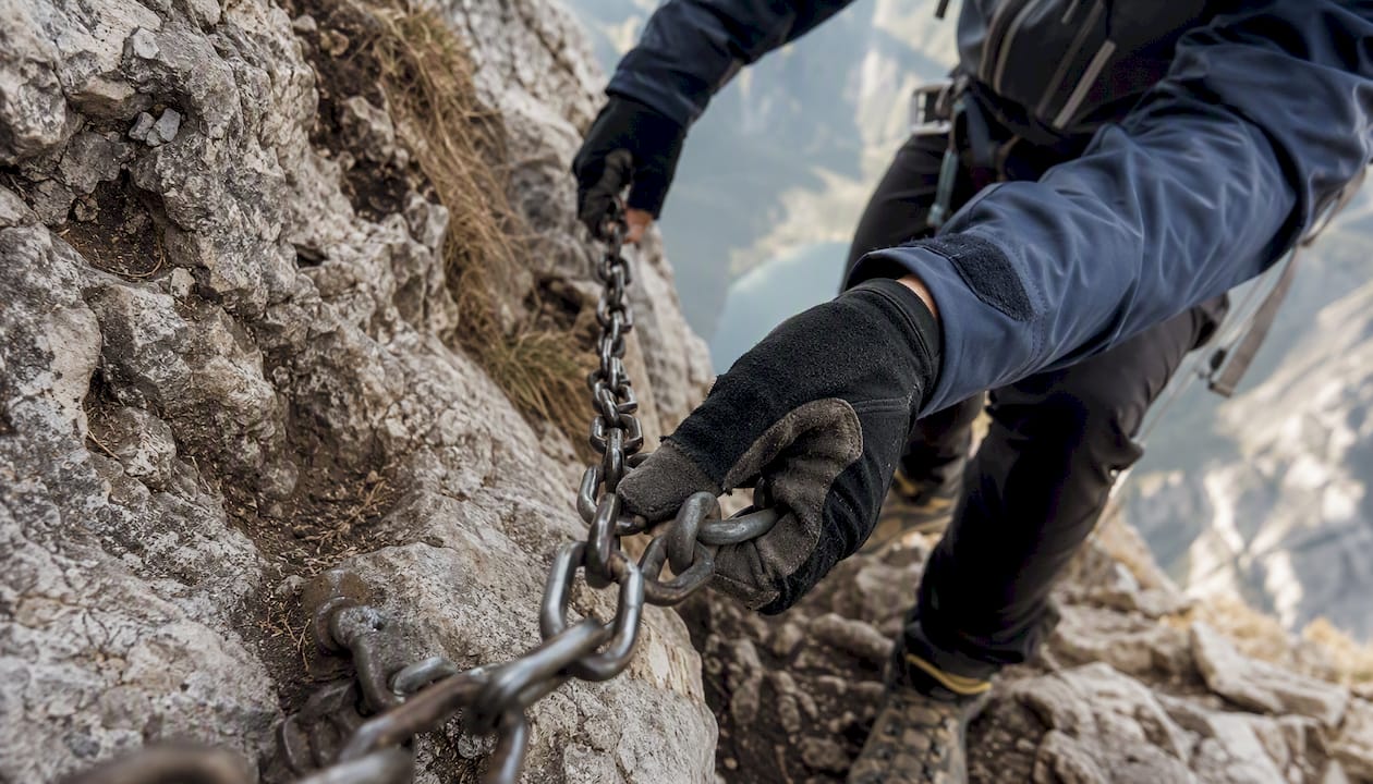
The final 100–200 m to the summit uses steel chains fixed into the rock face. Traffic is managed as one-way: a separate ascent and descent line reduces the risk of people passing on the exposed face, but it also means you cannot easily reverse your decision once you have started up. The rock is polished limestone, worn smooth by hundreds of thousands of boots. Even on a dry summer day, it offers less grip than it looks. Wet conditions make it significantly harder.
Physical demands
The elevation gain of 817–912 m (depending on the profile) is comparable to a moderate Scottish Munro approach, but compressed into a shorter horizontal distance. The steepness in the upper section means your legs will know about it the next morning. Hikers who regularly walk in hilly terrain and can manage 5–6 hours on their feet will find the physical side manageable. Those who rarely walk more than a few flat kilometres should build up before attempting it.
Lightning risk
The summit cross stands 15 m tall and acts as a lightning conductor. Afternoon thunderstorms in the Tatras can develop rapidly in summer afternoons. Getting caught on the chain section or the exposed ridge during a storm is genuinely dangerous. Check the Tatra National Park safety bulletins on the morning of your hike and watch the sky from Kondracka Pass before committing to the summit.
Fitness self-assessment:
- Comfortable walking 5–6 hours with a day pack? Yes.
- Happy on steep, rocky ground with some hand-use? Yes.
- Relaxed at exposed heights with a drop to one side? Yes.
- All three: you are ready for Giewont.
Pro Tip: Wear gloves. Not just for warmth — the chains are metal and the rock edges are sharp. A thin pair of leather or synthetic hiking gloves makes the scramble noticeably more comfortable and gives you better grip.
When is the best time to hike Giewont?
The trail is officially open from late spring through early autumn, with HikeList recommending May through September as the primary window. Outside those months, the chain section can be iced or snow-covered, and Tatra National Park may close sections of the route. Winter ascents require crampons, ice axes and experience; this guide does not cover them.
Within the season, timing matters enormously:
- May and June: Quieter, cooler, and the wildflowers on Hala Kondratowa are at their best. Snow can linger on the upper section into late May, so check conditions.
- July and August: Peak season. Queues at the chains can reach 60–90 minutes on summer weekends. The hike is still worth doing, but start no later than 07:00 and aim to be off the summit by 11:00.
- September: Often the best month. Crowds thin, the light is golden, and the weather is generally stable. Daylight starts to shorten, so an early start remains important.
- October: Possible but the window narrows. Expect cold mornings, potential ice above 1,600 m and shorter days.
Crowd-avoidance tactics:
- Start at 06:30 or earlier. The chains are often queue-free before 09:00 even in July.
- Choose a Tuesday, Wednesday or Thursday over a weekend.
- Avoid Polish public holidays, when domestic visitor numbers spike sharply.
- If you arrive at Kondracka Pass and the queue looks very long, consider descending and returning another day rather than standing exposed on a ridge for an hour.
How do UK travellers get to Kuźnice?
Zakopane is the base town for the Giewont hike, sitting roughly 100 km south of Kraków. Most UK travellers fly into Kraków John Paul II Airport (KRK), which has direct flights from several British airports.
Getting from Kraków to Zakopane:
- Private transfer: The fastest and most comfortable option. Door-to-door from Kraków city centre or the airport takes roughly 1.5–2 hours depending on traffic. ComFort Tours Cracow offers private transport from Kraków to Zakopane, which removes the need to navigate Polish bus timetables after a flight.
- Bus: PKS Zakopane and FlixBus run regular services from Kraków bus station (Dworzec Autobusowy). Journey time is 2–2.5 hours. Tickets are inexpensive and bookable online.
- Train: A slower option (2.5–3 hours with a change) and less convenient for early starts.
Getting from Zakopane to Kuźnice:
Kuźnice is about 2.5 km south of Zakopane town centre. Bus line 18 runs from the town centre to Kuźnice regularly in summer. A taxi takes around 5 minutes and costs a few Polish złoty. Driving is possible but parking at Kuźnice is limited and fills early on summer mornings; arriving by 06:30 usually secures a space, but later arrivals often find the car park full.
Combining with Kasprowy Wierch by cable car:
The Kasprowy Wierch cable car departs from Kuźnice. Tickets sell out quickly in peak season and must be booked online in advance via the PKL (Polskie Koleje Linowe) website. The cable car runs seasonally and is subject to weather closures. If you plan to combine both peaks in one day, book the cable car ticket before you leave the UK.
Pro Tip: Book your Kraków-to-Zakopane transfer the evening before your hike, not the morning of. Early-morning taxis from Kraków to Zakopane are harder to arrange at short notice, and missing your start window by an hour can mean the difference between a queue-free summit and a 90-minute wait at the chains.
Safety, weather and mountain rescue
Weather in the Tatras changes faster than almost anywhere in the British uplands. A clear morning can turn to a full electrical storm within two hours. The standard advice is to be off exposed ground by 13:00 in summer, which is entirely achievable with a 06:30 start.
Before you leave:
- Check the Tatra National Park visitor bulletins for closures and safety advisories on the morning of your hike.
- Look at the TOPR (Tatrzańskie Ochotnicze Pogotowie Ratunkowe) weather and avalanche bulletins, available on the TOPR website and app.
- If the forecast shows thunderstorms arriving before 14:00, postpone.
Lightning on the summit:
The summit cross is a known lightning attractor. If you hear thunder while on the ridge or at the chains, descend immediately. Do not shelter under the cross or near the chains. Move below the treeline as quickly as safely possible and crouch low, away from isolated trees and metal objects.
Emergency contacts:
- TOPR mountain rescue: 985 (from a Polish mobile or landline) or +48 18 206 34 44 from a UK mobile
- General emergency (Poland): 112
When calling mountain rescue, state your location as precisely as possible (trail name, approximate altitude, nearest waypoint), the nature of the emergency, the number of people affected, and your own phone number.
Group management on narrow sections:
- Keep your group together between Kondracka Pass and the summit. Separating on the chain section creates confusion and slows the one-way flow for everyone.
- Let faster parties pass at wider points on the approach trail.
- Never overtake on the chains themselves.
Pro Tip: Screenshot the TOPR emergency number and save it to your phone before you leave Zakopane. Polish mobile networks work on the approach trail but signal drops above Hala Kondratowa. Having the number already saved means you are not searching for it in an emergency.
What to pack for the Giewont day hike
Pack light but pack right. The ascent is steep enough that every unnecessary kilogram slows you down, but the exposed summit and fast-changing weather mean cutting corners on kit is a bad idea.
Essential kit:
- High-grip hiking boots with ankle support (trail runners are not adequate on the polished limestone chain section)
- Thin gloves for the chains
- Waterproof jacket and a spare mid-layer (temperatures drop sharply above 1,600 m)
- 1.5–2 litres of water (refill at Hala Kondratowa)
- High-energy snacks and lunch
- Headlamp (in case of delays pushing you past dusk)
- Fully charged phone with an offline map loaded
Optional but worth considering:
- Walking poles (useful on the descent; stow them before the chain section)
- Microspikes for May or October when ice is possible on the upper section
- Small first-aid kit with blister plasters and an elastic bandage
- Portable power bank for your phone
Leave anything non-essential in your accommodation. A 10–12 litre day pack is sufficient for this route.
Pro Tip: Wear your boots for at least two full days before the hike. New boots on polished limestone with a 900 m descent ahead of you is a reliable recipe for blisters. If you are hiring boots locally in Zakopane, test them on a short walk the afternoon before.
Mountain huts and facilities on the route
Two huts sit on the standard Kuźnice approach and both are worth knowing about.
Kalatówki mountain hut (Schronisko Kalatówki)
At 1,198 m, Kalatówki is the first stop after leaving Kuźnice, roughly 30–45 minutes into the walk. It serves hot drinks, soups and basic meals from early morning. Toilets are available. The hut is popular with families and day visitors who come no further, so it can be busy at weekends. On the way back down, it is a reliable place for a hot meal before the final walk to Kuźnice.
Hala Kondratowa shelter (Schronisko PTTK na Hali Kondratowej)
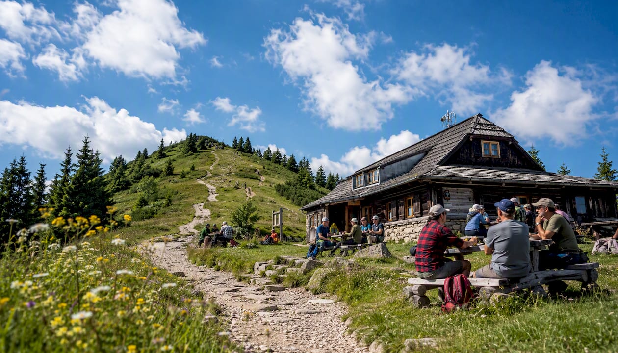
At 1,333 m, this is the last hut before the summit push and the most important stop on the route. Fill your water bottles here. The shelter serves food and hot drinks and has toilet facilities. Opening hours vary by season but it is generally open from around 07:00 during summer months. On busy days the queue for food can be 20–30 minutes, so factor that into your timing.
Above Hala Kondratowa, there are no facilities whatsoever. No water, no toilets, no shelter. The summit has the cross and the view; nothing else.
Pro Tip: Arrive at Hala Kondratowa before 09:00 on a summer weekend if you want a seat inside. After that, every table is taken and the queue for the counter stretches outside. Eat your snacks on the trail and just refill water here if time is tight.
Should you hike Giewont with a guide?
Self-guided is entirely possible if you are a confident hill walker, carry an offline map, and start early. The trail is well-marked with blue and red waymarkers, and the route to the summit is unambiguous. That said, there are genuine reasons to consider a guided ascent.
Advantages of going with a guide:
- Real-time weather decisions made by someone who knows the local patterns
- No logistics stress: transport from Kraków or Zakopane is arranged, parking is not your problem
- Group management on the chain section, where inexperienced hikers sometimes freeze or panic
- Local knowledge on crowd patterns, hut opening times and route variations
- A guide who speaks Polish can communicate with TOPR if an emergency arises
What ComFort Tours Cracow offers:
ComFort Tours Cracow runs small-group and private guided day trips to the Tatra Mountains from Kraków, including organised Giewont ascents. Groups are kept small, which matters on a route where large parties create bottlenecks at the chains. Transfers from Kraków are included, so you arrive at Kuźnice without having navigated Polish bus timetables at 05:30 in the morning. Guides provide local insight on the mountain’s history, including the cultural significance of the summit cross and the ‘Sleeping Knight’ profile the massif takes when viewed from Zakopane.
Booking:
Reserve your place via the ComFort Tours guided tours page. In peak season (July–August), book at least two weeks in advance. The guided day typically includes pickup from Kraków, the ascent with a qualified guide, and return transfer.
Pro Tip: If you are travelling as a couple or a small group and want flexibility on start time, a private guided option gives you the same logistics support as a group tour but lets you set the pace. Ask ComFort Tours Cracow about private arrangements when you enquire.
An honest take on the Giewont hike
Most online guides treat Giewont as a bucket-list tick and spend their energy on the view from the top. That framing quietly misleads people. The summit cross, the ‘Sleeping Knight’ silhouette, the panorama across the Western Tatras — all of it is real and worth the effort. But the hike earns its “hard” classification, and the thing that makes it hard is not the distance or the elevation gain. It is the combination of polished limestone, one-way managed exposure, and the speed at which the Tatra weather turns.
The conventional advice to “start early” is correct but rarely explained properly. A 06:30 start is not about beating the crowds for a better photo. It is about being off the exposed ridge before the afternoon electrical storms that build almost daily in July and August. The summit cross has been struck by lightning repeatedly over the years. Standing next to a 15 m iron cross on an exposed limestone ridge in a thunderstorm is not a situation you want to reason your way into.
What most guides also understate is the psychological demand of the chain section. The physical difficulty is moderate for anyone who walks regularly in the hills. The exposure is another matter. A narrow ledge with a significant drop, polished rock underfoot, and a queue of strangers above and below you is a different experience from reading about it. If you have not done anything similar before, do one or two scrambles in the UK first — something like Striding Edge on Helvellyn or the Aonach Eagach ridge in Scotland — before committing to Giewont.
The guided option is not just for nervous beginners. Experienced walkers who are visiting Zakopane for the first time and do not want to spend the evening before their hike navigating Polish transport logistics will find a guided day from Kraków genuinely worth it. The mountain does not get easier because you know the route; it gets easier because you are not tired before you start.
Plan your Giewont day with ComFort Tours Cracow
Sorting your own transport from Kraków to Kuźnice at 05:30, finding parking, and navigating the trail without local knowledge is entirely doable. It is also the part of the day most likely to go wrong before you have even laced your boots. ComFort Tours Cracow takes that off your plate entirely.

Small groups, an experienced local guide who knows the Tatra weather patterns and the chain section’s quirks, and a pickup from Kraków that gets you to Kuźnice at the right time: that is what a ComFort Tours Cracow Giewont day looks like. You focus on the mountain; the logistics are handled. After the descent, the Zakopane thermal baths make an excellent recovery stop before the return journey.
Browse the guided tour options and book your place. In peak season, spaces fill two to three weeks ahead.
Key Takeaways
A successful Giewont ascent comes down to three things: starting early enough to beat both the queues and the afternoon storms, wearing boots with genuine grip on polished limestone, and knowing when to turn back.
| Point | Details |
|---|---|
| Route recommendation | The blue trail via Hala Kondratowa from Kuźnice is the best first-timer route for the 11.8 km round trip. |
| Start time | Leave Kuźnice by 06:30 to reach the chains before queues and summit before midday storms. |
| Technical crux | The final 100–200 m chain section on polished limestone requires high-grip boots and gloves. |
| Emergency contact | Save TOPR mountain rescue (985 / +48 18 206 34 44) before leaving Zakopane. |
| Guided option | ComFort Tours Cracow provides small-group guided ascents with transfers from Kraków included. |
Sources
Before you hike, consult these resources directly rather than relying on memory.
Official and authoritative sources:
- Taterki
- Giewont Summit Trail Hiking Guide | Poland Tatras – HikeList
- Kuźnice – Giewont, Lesser Poland, Poland – 317 Reviews, Map | AllTrails
- Tatra National Park — visitor and park information
- Mt Giewont Guide: The Sleeping Knight Trail in Zakopane
Navigation:
FAQ
How difficult is the Giewont hike?
Giewont is classified as a hard day hike. The route involves roughly 11–12 km, up to 1,100 m of ascent, and a chain-secured scramble on polished limestone near the summit that requires comfort with exposure.
How long does it take to hike to Giewont?
Most walkers complete the Kuźnice round trip in 5–6 hours at an average pace. Add 30–60 minutes on busy summer weekends to account for queuing at the chain section.
What is Giewont famous for?
Giewont is famous for its 15 m iron summit cross, its ‘Sleeping Knight’ silhouette visible from Zakopane, and the exposed chain scramble that makes it one of the most distinctive peaks in the Polish Tatras.
Is the Giewont hike suitable for beginners?
Not for complete beginners. The chain section requires comfort with heights and exposed scrambling. Walkers who regularly hike in hilly terrain and have some experience on rocky ground will manage it; those new to mountain walking should build experience first.
Can I book a guided Giewont hike from Kraków?
Yes. ComFort Tours Cracow offers small-group and private guided Giewont day trips with transfers from Kraków, making it straightforward for UK travellers to reach Kuźnice and complete the ascent with local support.